A large majority of worldwide fresh water withdrawals are for agricultural use and specifically for crop irrigation. This is especially the case in developing countries, but even in the European Mediterranean region the agricultural water use can comprise up to 70% of freshwater resources. These resources are all under large pressure due to overpopulation and poor water governance.Therefore, the use of modern technology to improve crop water use efficiency at field and irrigation scheme levels is an urgent necessity.
Our services on catchment, regional and country scale are centered around:
Estimating crop water use efficiency using satellites
Assessing catchment and basin hydrology using a global hydrological model
Monitoring and forecasting droughts and floods around agricultural hot spots
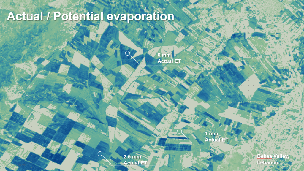
Water use efficiency from satellites
Satellite remote sensing can help monitor, plan and govern water use over time by providing consistent, independent and reliable estimates of water use efficiency across large regions.
Agri360 generates regional and country scale maps of hydrological key parameters such as actual and potential evapotranspiration throughout the growing season is and compares this to yield or yield proxies allowing growers, technicians and irrigation district managers to manage irrigation and of great interest to agriculture.
Actual evapotranspiration can be forecasted with Agri360 at field scale level and covering large regions
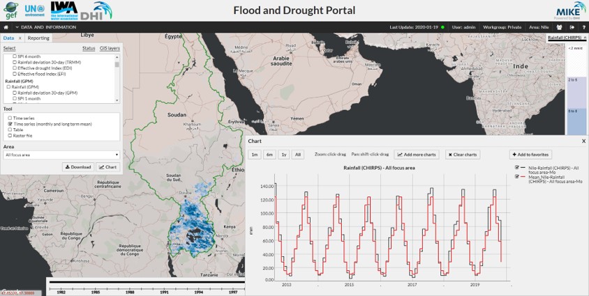
Flood and Drought analytics
Agri360 flood and drought analytics enables users, such as agricultural ministries and transboundary river authorities, to access technical applications to support planning for flood and drought events. The data provided by the portal are near real time.
Support planning and decisions to address flood and drought risks from transboundary basin level to water utilities.
Applications include Issue Analysis, Water Indicators, Data and Information, Drought Assessment, Crop Application, Flood Assessment, Basin Planning, Water Safety Planning, Robust Decision Making Tool.
User configured rainfall and drought reports
Automated warnings based on peak events or scheduled dates.
Agri360 provide operational tools and portals for drought monitoring, early warning and planning.